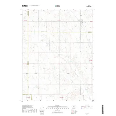
2018 Map of Hunter
USGS Topo · Published 2018About this map
Hunter serves as the primary hub of this North Central Kansas landscape, situated near the convergence of Mitchell, Lincoln, Osborne, and Russell counties. The terrain is defined by the branching drainage of Spillman Cr, including the distinct paths of N Br Spillman Cr and S Br Spillman Cr as they cut through the rural sections. These waterways dictated the placement of early infrastructure, with crossings often near family and community landmarks. Genealogists will find significant value in the distribution of regional burial sites, such as Greenwood Union Cem, Elm Creek Cem, and Spillman Cem, which are scattered along the section lines. The map also traces the winding course of Bacon Cr in the northeast, illustrating the traditional rural grid of roads like Ash Grove Rd and Co Line Rd that tie these small agricultural communities together.
Find a feature on this map
40 named features on this map. Tap any name to fly to it.
Don’t see what you’re looking for? This feature index may not catch every label — zoom into the map to look around manually.
Map Details
Editions of this 2018 Hunter Map
This is the sole edition of this map. No revisions or reprints were ever made.
Other maps of this area

1894 · Beloit
USGS Topo · 1:125,000

1896 · Osborne
USGS Topo · 1:125,000

1955 · Beloit
USGS Topo · 1:250,000

1959 · Beloit
USGS Topo · 1:250,000

1962 · Vesper
USGS Topo · 1:24,000

1963 · Sylvan Grove
USGS Topo · 1:24,000

1967 · Hunter
USGS Topo · 1:24,000
1968 · Ash Grove
USGS Topo · 1:24,000
1978 · Tipton
USGS Topo · 1:24,000
1978 · Lucas
USGS Topo · 1:24,000