
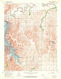
1962 Map of Vesper
USGS Topo · Published 1964About this map
The Saline River corridor defines this portion of Lincoln County, where the valley floor transitions into the uplands of central Kansas. During the early 1960s, the landscape was anchored by the small settlements of Vesper, Denmark, and Grant, each serving as nodes for the surrounding agricultural community. Transportation is a primary feature of the sheet, with the Union Pacific railroad tracking the southern river valley while the Atchison Topeka and Santa Fe line cuts across the northern section through the Spillman Creek basin. Local history and genealogy are well-represented by several distinct burial sites, including Vesper Cem, Mission Cem, Pottersburg Cem, and St John Cem. The area’s geography is further shaped by numerous quarries and gravel pits, reflecting the local extractive industry that supported road and rail development.
Find a feature on this map
22 named features on this map. Tap any name to fly to it.
Don’t see what you’re looking for? This feature index may not catch every label — zoom into the map to look around manually.
Map Details
Editions of this 1962 Vesper Map
This is the sole edition of this map. No revisions or reprints were ever made.
Other maps of this area

1894 · Ellsworth
USGS Topo · 1:125,000

1894 · Beloit
USGS Topo · 1:125,000

1955 · Great Bend
USGS Topo · 1:250,000

1955 · Beloit
USGS Topo · 1:250,000

1957 · Great Bend
USGS Topo · 1:250,000

1958 · Great Bend
USGS Topo · 1:250,000

1959 · Beloit
USGS Topo · 1:250,000

1962 · Lincoln
USGS Topo · 1:24,000

1963 · Sylvan Grove
USGS Topo · 1:24,000
1964 · Wilson NW
USGS Topo · 1:24,000