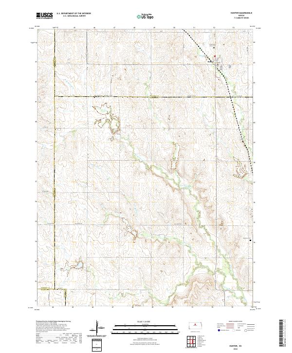
2022 Map of Hunter
USGS Topo · Published 2022About this map
Hunter serves as the primary community in this rural Kansas landscape, where the town grid is defined by Gaylord St and Wagner St. Located in Mitchell County, the settlement is surrounded by a network of drainage systems including Bacon Cr and the various branches of Spillman Cr. The geography here is defined by these subtle watercourses that have carved paths through the agricultural sections.
Find a feature on this map
42 named features on this map. Tap any name to fly to it.
Don’t see what you’re looking for? This feature index may not catch every label — zoom into the map to look around manually.
Map Details
Editions of this 2022 Hunter Map
This is the sole edition of this map. No revisions or reprints were ever made.
Other maps of this area

1894 · Beloit
USGS Topo · 1:125,000

1896 · Osborne
USGS Topo · 1:125,000

1955 · Beloit
USGS Topo · 1:250,000

1959 · Beloit
USGS Topo · 1:250,000

1962 · Vesper
USGS Topo · 1:24,000

1963 · Sylvan Grove
USGS Topo · 1:24,000

1967 · Hunter
USGS Topo · 1:24,000
1968 · Ash Grove
USGS Topo · 1:24,000
1978 · Tipton
USGS Topo · 1:24,000
1978 · Lucas
USGS Topo · 1:24,000