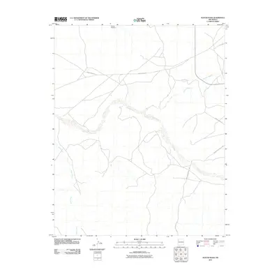
2010 Map of Hunter Wash
USGS Topo · Published 2010About this map
Chaco River and De-na-zin Wash converge in this arid landscape, carving intricate drainage patterns across the high desert. The terrain is defined by the Chaco Plateau to the north, a region characterized by sparse vegetation and significant elevation changes marked by the Indian Creek drainage system. A network of essential transit corridors provides the primary infrastructure for the area, including the Indian Service Rte and Indian Service Route 7080. These routes reflect the modern management of Navajo Nation lands, connecting remote points across the San Juan Basin. The absence of concentrated settlements highlights the sprawling, rural nature of the Shiprock Agency at the beginning of the twenty-first century, where the focus remains on the natural topography and the historical importance of the river systems.
Find a feature on this map
7 named features on this map. Tap any name to fly to it.
Don’t see what you’re looking for? This feature index may not catch every label — zoom into the map to look around manually.
Map Details
Editions of this 2010 Hunter Wash Map
This is the sole edition of this map. No revisions or reprints were ever made.
Other maps of this area

1889 · Chaco
USGS Topo · 1:250,000

1892 · Chaco
USGS Topo · 1:250,000

1927 · Sulphur Spring
USGS Topo · 1:96,000

1928 · Kirtland
USGS Topo · 1:125,000

1932 · Kirtland
USGS Topo · 1:125,000

1954 · Shiprock
USGS Topo · 1:250,000

1958 · Shiprock
USGS Topo · 1:250,000

1959 · Shiprock
USGS Topo · 1:250,000
1966 · Tanner Lake
USGS Topo · 1:24,000
1966 · Alamo Mesa West
USGS Topo · 1:24,000