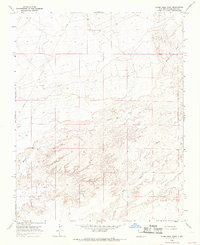
1966 Map of Alamo Mesa West
USGS Topo · Published 1969About this map
Alamo Mesa dominates this high-desert landscape in San Juan County, where deep drainage patterns reveal a complex network of seasonal waterways. The terrain is defined by the convergence of Hunter Wash, Willow Wash, and Alamo Wash, illustrating the erosional forces that have shaped this portion of the New Mexico badlands. This 1966 field-checked survey by the Geological Survey captures the area during a period of expanding resource exploration, evidenced by the infrastructure cutting across the plateau.
Find a feature on this map
10 named features on this map. Tap any name to fly to it.
Don’t see what you’re looking for? This feature index may not catch every label — zoom into the map to look around manually.
Map Details
Editions of this 1966 Alamo Mesa West Map
2 editions found
Other maps of this area

1889 · Chaco
USGS Topo · 1:250,000

1892 · Chaco
USGS Topo · 1:250,000

1927 · Sulphur Spring
USGS Topo · 1:96,000

1928 · Kirtland
USGS Topo · 1:125,000

1932 · Kirtland
USGS Topo · 1:125,000

1954 · Shiprock
USGS Topo · 1:250,000

1958 · Shiprock
USGS Topo · 1:250,000

1959 · Shiprock
USGS Topo · 1:250,000
1966 · Tanner Lake
USGS Topo · 1:24,000
1966 · Alamo Mesa East
USGS Topo · 1:24,000