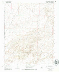
1966 Map of Alamo Mesa West
USGS Topo · Published 1986About this map
Alamo Mesa dominates the southern landscape of this high desert region in San Juan County, New Mexico, during the mid-1960s. The terrain is defined by an intricate network of erosional drainage channels, most notably Hunter Wash, Willow Wash, and Alamo Wash, which cut through the arid soil. Human activity is marked primarily by resource extraction and infrastructure, evidenced by a large Pipeline traversing the northern sections and scattered industrial markers like a Well and a Drill Hole. This 1966 field-checked survey reveals a sparsely populated area where the economy was likely tied to grazing and emerging energy exploration, captured just as aerial photogrammetry was becoming the standard for documenting these expansive western landscapes.
Find a feature on this map
7 named features on this map. Tap any name to fly to it.
Don’t see what you’re looking for? This feature index may not catch every label — zoom into the map to look around manually.
Map Details
Editions of this 1966 Alamo Mesa West Map
2 editions found
Other maps of this area

1889 · Chaco
USGS Topo · 1:250,000

1892 · Chaco
USGS Topo · 1:250,000

1927 · Sulphur Spring
USGS Topo · 1:96,000

1928 · Kirtland
USGS Topo · 1:125,000

1932 · Kirtland
USGS Topo · 1:125,000

1954 · Shiprock
USGS Topo · 1:250,000

1958 · Shiprock
USGS Topo · 1:250,000

1959 · Shiprock
USGS Topo · 1:250,000
1966 · Tanner Lake
USGS Topo · 1:24,000
1966 · Alamo Mesa East
USGS Topo · 1:24,000