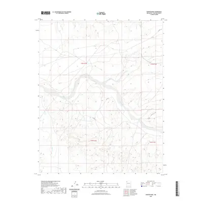
2020 Map of Hunter Wash
USGS Topo · Published 2020About this map
The Chaco River cuts a prominent course through this high-desert landscape in the Shiprock Agency region, defining the drainage patterns for the surrounding high country. This 2020 topographic study illustrates a network of essential service roads and rural routes that provide access through the complex terrain of San Juan County. Major ephemeral waterways like De-na-zin Wash and Indian Cr intersect the land, showing how seasonal runoff has carved the area's distinct topography. The presence of Indian Svc Rte 7060 and various county roads such as Co Rd 8850 and Co Rd 7745 highlights the modern infrastructure supporting this part of the Navajo Nation, facilitating movement between remote reaches and regional hubs.
Find a feature on this map
13 named features on this map. Tap any name to fly to it.
Don’t see what you’re looking for? This feature index may not catch every label — zoom into the map to look around manually.
Map Details
Editions of this 2020 Hunter Wash Map
This is the sole edition of this map. No revisions or reprints were ever made.
Other maps of this area

1889 · Chaco
USGS Topo · 1:250,000

1892 · Chaco
USGS Topo · 1:250,000

1927 · Sulphur Spring
USGS Topo · 1:96,000

1928 · Kirtland
USGS Topo · 1:125,000

1932 · Kirtland
USGS Topo · 1:125,000

1954 · Shiprock
USGS Topo · 1:250,000

1958 · Shiprock
USGS Topo · 1:250,000

1959 · Shiprock
USGS Topo · 1:250,000
1966 · Tanner Lake
USGS Topo · 1:24,000
1966 · Alamo Mesa West
USGS Topo · 1:24,000