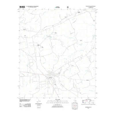
2010 Map of Huntington
USGS Topo · Published 2010About this map
Huntington serves as the central hub of this East Texas landscape, where a dense network of local roads like Cowart St and E Pine St meet. The surrounding terrain is defined by a high concentration of family and community burial grounds, including Jonesville Cemetery, Rocky Hill Cemetery, and the McClure Cemetery on the eastern edge. These sites, along with small settlements such as Dunagan, Alco, and Rocky Springs, offer a detailed look at the rural social geography of Angelina County.
Find a feature on this map
68 named features on this map. Tap any name to fly to it.
Don’t see what you’re looking for? This feature index may not catch every label — zoom into the map to look around manually.
Map Details
Editions of this 2010 Huntington Map
This is the sole edition of this map. No revisions or reprints were ever made.
Other maps of this area

1931 · Zavalla
USGS Topo · 1:62,500

1932 · Manning
USGS Topo · 1:62,500

1949 · Lufkin
USGS Topo · 1:62,500

1949 · Platt
USGS Topo · 1:24,000

1949 · Lufkin
USGS Topo · 1:24,000

1949 · Huntington
USGS Topo · 1:24,000

1950 · Platt
USGS Topo · 1:24,000

1950 · Lufkin
USGS Topo · 1:24,000

1950 · Redland
USGS Topo · 1:24,000

1950 · Huntington
USGS Topo · 1:24,000