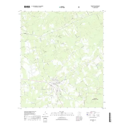
2019 Map of Huntington
USGS Topo · Published 2019About this map
Huntington serves as the central hub of this East Texas landscape, where the town's street grid meets a web of rural roads and timberlands. The surrounding area is defined by a dense network of family-named landmarks and resting places, including the Huntington Cem, Jonesville Cem, and Rocky Hill Cem. These sites, along with others like the Naren Cem near Hans Lake, offer significant value for genealogists tracing local family lineages. To the southeast, the terrain transitions into the protected borders of the Angelina National Forest, while the north and west are carved by numerous waterways such as Mill Cr and Anderson Cr. The geography reflects the region's enduring connection to the forest and the small rural settlements like Dunagan that persist along the county routes.
Find a feature on this map
117 named features on this map. Tap any name to fly to it.
Don’t see what you’re looking for? This feature index may not catch every label — zoom into the map to look around manually.
Map Details
Editions of this 2019 Huntington Map
This is the sole edition of this map. No revisions or reprints were ever made.
Other maps of this area

1931 · Zavalla
USGS Topo · 1:62,500

1932 · Manning
USGS Topo · 1:62,500

1949 · Lufkin
USGS Topo · 1:62,500

1949 · Platt
USGS Topo · 1:24,000

1949 · Lufkin
USGS Topo · 1:24,000

1949 · Huntington
USGS Topo · 1:24,000

1950 · Platt
USGS Topo · 1:24,000

1950 · Lufkin
USGS Topo · 1:24,000

1950 · Redland
USGS Topo · 1:24,000

1950 · Huntington
USGS Topo · 1:24,000