
Loading...
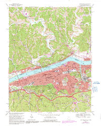
Loading map...1957 Map of Huntington
USGS Topo · Published 1959About this map
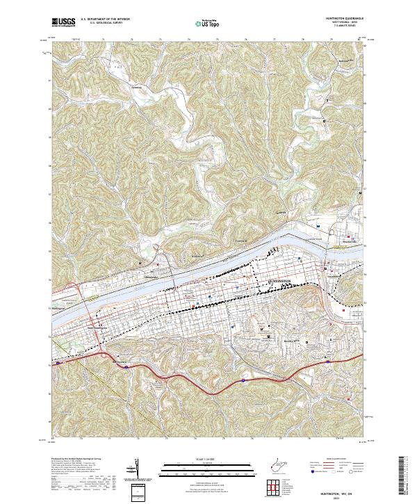
The Ohio River valley at the confluence of the Guyandotte River shows a dense urban and industrial network in the late 1950s. Huntington is the anchor of this landscape, its grid extending from West Huntington through the historic Guyandotte neighborhood. The presence of Marshall College and multiple hospitals, including Huntington State Hospital, signals the city's role as a regional hub for education and healthcare.
Find a feature on this map
95 named features on this map. Tap any name to fly to it.
Don’t see what you’re looking for? This feature index may not catch every label — zoom into the map to look around manually.
Map Details
Date Portrayed1957
Date Published1959
PublisherU.S. Geological Survey
Map TypeTopographic
Scale1:24,000
Physical Dimensions22.1 x 27 inches
Editions of this 1957 Huntington Map
This is the sole edition of this map. No revisions or reprints were ever made.
Historical Maps of Huntington Through Time
9 maps found


Featured Locations
Source Details
SourceU.S. Geological Survey
CopyrightPublic Domain