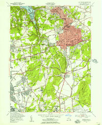
1954 Map of Huntington
USGS Topo · Published 1956About this map
Cold Spring Harbor and the surrounding Nassau-Suffolk borderlands reflect the mid-century suburbanization of Long Island, anchored by historic coastal estates and inland development. This 1954 revision documents the cultural landscape of Huntington and Huntington Station as the postwar housing boom began to fill the spaces between established hamlets like Syosset and Woodbury. The map preserves the site of the Walt Whitman Birthplace alongside modern institutions of the era, such as the Nassau County Sanatorium and the Long Island Agricultural and Technical Institute.
Find a feature on this map
75 named features on this map. Tap any name to fly to it.
Don’t see what you’re looking for? This feature index may not catch every label — zoom into the map to look around manually.
Map Details
Editions of this 1954 Huntington Map
2 editions found
Other maps of this area

1897 · Hempstead
USGS Topo · 1:62,500

1897 · Oyster Bay
USGS Topo · 1:62,500

1898 · Hempstead
USGS Topo · 1:62,500

1898 · Oyster Bay
USGS Topo · 1:62,500

1899 · Hempstead
USGS Topo · 1:62,500

1900 · Oyster Bay
USGS Topo · 1:62,500

1901 · Babylon
USGS Topo · 1:62,500

1901 · Northport
USGS Topo · 1:62,500

1903 · Babylon
USGS Topo · 1:62,500

1903 · Northport
USGS Topo · 1:62,500