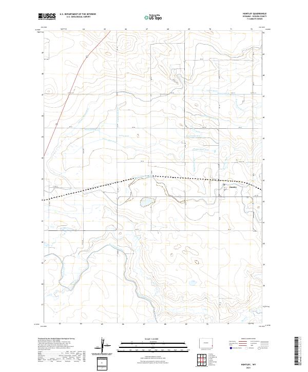
2021 Map of Huntley
USGS Topo · Published 2021About this map
Huntley sits at the heart of an intricate water-management landscape in Goshen County, where the desert environment has been reshaped for agriculture. The settlement is surrounded by a dense network of irrigation infrastructure, including the Springer Main Lateral and the E Springer Main Lateral. These canals and laterals are part of a larger system that redirects water from the Fort Laramie Canal and Horse Cr to support the local farming economy.
Find a feature on this map
45 named features on this map. Tap any name to fly to it.
Don’t see what you’re looking for? This feature index may not catch every label — zoom into the map to look around manually.
Map Details
Editions of this 2021 Huntley Map
This is the sole edition of this map. No revisions or reprints were ever made.
Other maps of this area

1896 · Patrick
USGS Topo · 1:125,000

1899 · Goshen Hole
USGS Topo · 1:125,000

1954 · Torrington
USGS Topo · 1:250,000

1954 · Cheyenne
USGS Topo · 1:250,000

1958 · Cheyenne
USGS Topo · 1:250,000

1958 · Torrington
USGS Topo · 1:250,000

1960 · Huntley
USGS Topo · 1:24,000

1960 · Hawk Springs
USGS Topo · 1:24,000

1960 · Lyman
USGS Topo · 1:24,000
1960 · Duroc
USGS Topo · 1:24,000