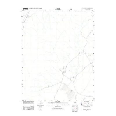
2011 Map of Huntoon Valley
USGS Topo · Published 2011About this map
Huntoon Valley dominates this high-desert basin in Mineral County, Nevada, where the sparse geography reveals a landscape shaped by water access and back-country routes. The map illustrates a primarily undeveloped region defined by the presence of Granite Spring and the drainage patterns that feed into the valley floor. Evidence of seasonal or specialized land use appears at Cow Camp, a localized settlement point indicative of the area's ranching or grazing history. Access through the basin is facilitated by a network of unimproved roads and the NFD 200 Trl, showcasing the essential infrastructure required to navigate this portion of the Great Basin during the early twenty-first century.
Find a feature on this map
5 named features on this map. Tap any name to fly to it.
Don’t see what you’re looking for? This feature index may not catch every label — zoom into the map to look around manually.
Map Details
Editions of this 2011 Huntoon Valley Map
This is the sole edition of this map. No revisions or reprints were ever made.
Other maps of this area

1909 · Hawthorne
USGS Topo · 1:250,000

1911 · Hawthorne
USGS Topo · 1:250,000

1915 · Hawthorne
USGS Topo · 1:250,000

1948 · Walker Lake
USGS Topo · 1:250,000

1955 · Powell Mtn
USGS Topo · 1:62,500

1957 · Walker Lake
USGS Topo · 1:250,000

1958 · Huntoon Valley
USGS Topo · 1:62,500

1962 · Walker Lake
USGS Topo · 1:250,000

1964 · Walker Lake
USGS Topo · 1:250,000
1967 · Jacks Spring
USGS Topo · 1:24,000