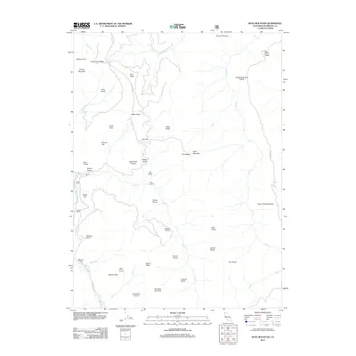
2012 Map of Hupa Mountain
USGS Topo · Published 2012About this map
Hupa Mountain and the surrounding Humboldt County wilderness are defined by an intricate network of named prairies and flats that break the timbered ridges. This 2012 survey illustrates a landscape where small, localized settlements and working landholdings like Stover Ranch and Cookson Ranch are scattered among geographic landmarks. The naming conventions—including Studhorse Prairie, Hundred Acre Flat, and Potato Patch—suggest a history of grazing, homesteading, and resource use. Transport is limited to narrow corridors such as Coyote Peak Rd and Pine Ridge Rd, reflecting the remote nature of the terrain. Drainages like Redwood Cr and Lacks Cr carve deep through the topography, connecting prominent heights like Beaver Butte with lower reaches like Sandy Bar.
Find a feature on this map
50 named features on this map. Tap any name to fly to it.
Don’t see what you’re looking for? This feature index may not catch every label — zoom into the map to look around manually.
Map Details
Editions of this 2012 Hupa Mountain Map
This is the sole edition of this map. No revisions or reprints were ever made.
Other maps of this area

1915 · Big Bar and Vicinity
USGS Topo · 1:250,000

1922 · Korbel
USGS Topo · 1:62,500

1922 · China Flat
USGS Topo · 1:62,500

1925 · Hoopa
USGS Topo · 1:125,000

1945 · Coyote Peak
USGS Topo · 1:62,500

1945 · Blue Lake
USGS Topo · 1:62,500

1948 · Weed
USGS Topo · 1:250,000

1950 · Weed
USGS Topo · 1:250,000

1951 · Blue Lake
USGS Topo · 1:62,500

1952 · Willow Creek
USGS Topo · 1:62,500