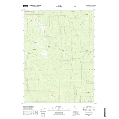
2018 Map of Hupa Mountain
USGS Topo · Published 2018About this map
Redwood National Park and the Six Rivers National Forest dominate this rugged terrain in Humboldt County. The landscape is defined by a series of prominent ridges and peaks, including the high point at Hupa Mtn, Ranger Mtn in the north, and Sugar Pine Mtn to the east. Water drains through steep drainages like Redwood Creek and Lacks Creek, revealing the complex topography of the California Coast Ranges. Evidence of local navigation and land management appears through established routes such as Arbor Camp Ridge Rd and the Pine Ridge Trail, connecting isolated points like Eagle Rock and White Rocks. This topographic study documents the region's wilderness character and the enduring forestry boundaries that shape this part of Northern California.
Find a feature on this map
42 named features on this map. Tap any name to fly to it.
Don’t see what you’re looking for? This feature index may not catch every label — zoom into the map to look around manually.
Map Details
Editions of this 2018 Hupa Mountain Map
This is the sole edition of this map. No revisions or reprints were ever made.
Other maps of this area

1915 · Big Bar and Vicinity
USGS Topo · 1:250,000

1922 · Korbel
USGS Topo · 1:62,500

1922 · China Flat
USGS Topo · 1:62,500

1925 · Hoopa
USGS Topo · 1:125,000

1945 · Coyote Peak
USGS Topo · 1:62,500

1945 · Blue Lake
USGS Topo · 1:62,500

1948 · Weed
USGS Topo · 1:250,000

1950 · Weed
USGS Topo · 1:250,000

1951 · Blue Lake
USGS Topo · 1:62,500

1952 · Willow Creek
USGS Topo · 1:62,500