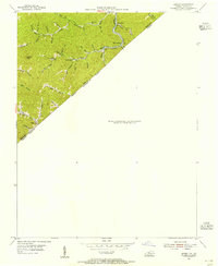
1954 Map of Hurley
USGS Topo · Published 1955About this map
The narrow valleys of the Cumberland Plateau define this 1954 topographic survey, where the Pike Co and Buchanan Co border meets the Kentucky Virginia state line. The landscape is dominated by the Norfolk and Western rail corridor, which snakes through the hills alongside Hurricane Creek and Middle Elk Creek. Small coal-era rail stops such as Argo, Burke Siding, and Bill Siding cluster along the tracks, serving as the primary hubs for these tightly wound hollows.
Find a feature on this map
41 named features on this map. Tap any name to fly to it.
Don’t see what you’re looking for? This feature index may not catch every label — zoom into the map to look around manually.
Map Details
Editions of this 1954 Hurley Map
This is the sole edition of this map. No revisions or reprints were ever made.
Other maps of this area

1886 · Grundy
USGS Topo · 1:125,000

1887 · Warfield
USGS Topo · 1:125,000

1890 · Grundy
USGS Topo · 1:125,000

1891 · Tazewell
USGS Topo · 1:125,000

1891 · Oceana
USGS Topo · 1:125,000

1891 · Warfield
USGS Topo · 1:125,000

1892 · Grundy
USGS Topo · 1:125,000

1893 · Oceana
USGS Topo · 1:125,000

1895 · Tazewell
USGS Topo · 1:125,000

1897 · Tazewell
USGS Topo · 1:125,000