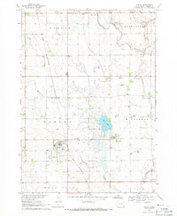
1968 Map of Hurley
USGS Topo · Published 1971About this map
The town of Hurley serves as the focal point of this late-1960s survey, situated along the Chicago and North Western railroad line. The landscape is defined by the agricultural and hydrological patterns of the northern plains, where the Vermillion River flows through the eastern portion of the quadrangle, joined by smaller tributaries like Fly Creek and Hurley Creek. These watercourses dictate the placement of local infrastructure and land divisions across the townships of Parker, Germantown, Hurley, Middleton, Swan Lake, and Turner.
Find a feature on this map
18 named features on this map. Tap any name to fly to it.
Don’t see what you’re looking for? This feature index may not catch every label — zoom into the map to look around manually.
Map Details
Editions of this 1968 Hurley Map
This is the sole edition of this map. No revisions or reprints were ever made.
Other maps of this area

1897 · Canton
USGS Topo · 1:125,000

1898 · Parker
USGS Topo · 1:125,000

1900 · Canton
USGS Topo · 1:125,000

1955 · Sioux Falls
USGS Topo · 1:250,000

1958 · Sioux Falls
USGS Topo · 1:250,000

1962 · Lennox NW
USGS Topo · 1:24,000

1964 · Lennox
USGS Topo · 1:24,000
1968 · Beresford NW
USGS Topo · 1:24,000
1968 · Parker NE
USGS Topo · 1:24,000

1968 · Parker SW
USGS Topo · 1:24,000