
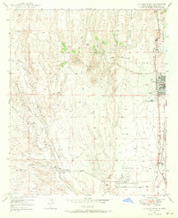
1949 Map of Hurley West
USGS Topo · Published 1966About this map
Hurley stands as the primary industrial and residential hub on this southwestern landscape, mapped shortly after the war in the late 1940s. The town's layout is defined by its proximity to the Atchison Topeka and Santa Fe railroad and the presence of the Hurley Cem to its south. The terrain is dominated by the prominent elevation of Lone Mountain and a network of watercourses including Cameron Creek and the Rio de Arenas.
Find a feature on this map
15 named features on this map. Tap any name to fly to it.
Don’t see what you’re looking for? This feature index may not catch every label — zoom into the map to look around manually.
Map Details
Editions of this 1949 Hurley West Map
2 editions found
Other maps of this area

1909 · Silver City
USGS Topo · 1:125,000

1937 · Santa Rita
USGS Topo · 1:24,000

1947 · Faywood Station
USGS Topo · 1:24,000

1947 · Fort Bayard
USGS Topo · 1:24,000

1948 · Santa Rita
USGS Topo · 1:24,000

1948 · Hurley East
USGS Topo · 1:24,000

1949 · Fort Bayard
USGS Topo · 1:24,000

1949 · Whitewater
USGS Topo · 1:24,000

1949 · Hurley East
USGS Topo · 1:24,000

1949 · Faywood Station
USGS Topo · 1:24,000