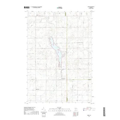
2018 Map of Huron
USGS Topo · Published 2018About this map
Otter Lake serves as a central geographic feature in this north-central Wisconsin landscape, where the borders of Chippewa, Taylor, and Clark Counties meet. The settlement of Huron sits at the northern edge of the map, while Brownville and Maple Hill anchor the southern reaches near the Wolf River. The terrain is characterized by a dense network of sectional roads, including Co Line Rd and 110th Ave, which overlay a landscape rich with wetlands and small water bodies like Withrow Lake. A significant cultural and recreational corridor is formed by the Ice Age National Scenic Trail, which winds north-to-south through the center of the sheet. This 2018 survey illustrates the persistent rural character of the region, where small named communities are linked by gravel and paved county roads across the headwaters of Little Otter Cr and Roger Cr.
Find a feature on this map
39 named features on this map. Tap any name to fly to it.
Don’t see what you’re looking for? This feature index may not catch every label — zoom into the map to look around manually.
Map Details
Editions of this 2018 Huron Map
This is the sole edition of this map. No revisions or reprints were ever made.
Other maps of this area

1951 · Cornell
USGS Topo · 1:62,500

1951 · Gilman
USGS Topo · 1:62,500

1952 · Cadott
USGS Topo · 1:62,500

1952 · Stanley
USGS Topo · 1:62,500

1953 · Eau Claire
USGS Topo · 1:250,000

1953 · Rice Lake
USGS Topo · 1:250,000

1958 · Eau Claire
USGS Topo · 1:250,000

1959 · Rice Lake
USGS Topo · 1:250,000

1964 · Eau Claire
USGS Topo · 1:250,000
1973 · Colburn
USGS Topo · 1:24,000