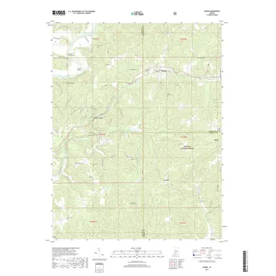
2019 Map of Huron
USGS Topo · Published 2019About this map
Huron sits at the junction of rail and road in this 2019 survey of the Lawrence and Martin County borderlands. The landscape is defined by the winding course of the East Fork White River, which carves distinct landmarks such as Rock Bend, Devils Elbow, and Old Mans Nose. Much of the southern and eastern terrain is preserved within the Hoosier National Forest, where a network of trails like the Cookshack Trail and Tank Spring Trail navigate the wooded ridges and hollows.
Find a feature on this map
70 named features on this map. Tap any name to fly to it.
Don’t see what you’re looking for? This feature index may not catch every label — zoom into the map to look around manually.
Map Details
Editions of this 2019 Huron Map
This is the sole edition of this map. No revisions or reprints were ever made.
Other maps of this area

1935 · Oolitic
USGS Topo · 1:48,000

1942 · Oolitic
USGS Topo · 1:62,500

1948 · Huron
USGS Topo · 1:24,000

1949 · Georgia
USGS Topo · 1:24,000

1950 · Huron
USGS Topo · 1:24,000

1950 · Shoals
USGS Topo · 1:24,000

1951 · Hillham
USGS Topo · 1:24,000

1951 · French Lick
USGS Topo · 1:24,000

1951 · Georgia
USGS Topo · 1:24,000

1956 · Rusk
USGS Topo · 1:24,000