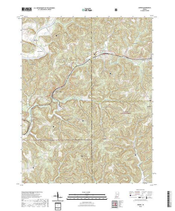
2022 Map of Huron
USGS Topo · Published 2022About this map
The East Fork White River carves a winding path across the northwest corner of this region, creating distinct landforms like Norman Rock Bend, Devils Elbow, and the ridge known as Old Mans Nose. This rural area in southern Indiana is characterized by narrow valleys and wooded ridges, much of which is preserved within the Hoosier National Forest. The settlement pattern is largely dispersed, with small communities such as Huron and Willow Valley serving as local anchors.
Find a feature on this map
67 named features on this map. Tap any name to fly to it.
Don’t see what you’re looking for? This feature index may not catch every label — zoom into the map to look around manually.
Map Details
Editions of this 2022 Huron Map
This is the sole edition of this map. No revisions or reprints were ever made.
Other maps of this area

1935 · Oolitic
USGS Topo · 1:48,000

1942 · Oolitic
USGS Topo · 1:62,500

1948 · Huron
USGS Topo · 1:24,000

1949 · Georgia
USGS Topo · 1:24,000

1950 · Huron
USGS Topo · 1:24,000

1950 · Shoals
USGS Topo · 1:24,000

1951 · Hillham
USGS Topo · 1:24,000

1951 · French Lick
USGS Topo · 1:24,000

1951 · Georgia
USGS Topo · 1:24,000

1956 · Rusk
USGS Topo · 1:24,000