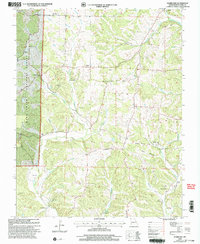
2000 Map of Hurricane
USGS Topo · Published 2003About this map
Mark Twain National Forest dominates the western portion of this Missouri landscape, where the rugged topography of the Ozark Plateau is carved by a dense network of drainages. Rural life in this corner of Bollinger County is defined by small crossroads settlements and a high concentration of community landmarks. Landmarks such as Younts Store and Tallent anchor the map, while spiritual and ancestral history is preserved at sites like Old Concord Ch, Pleasant Valley Ch, and Old Concord Cem.
Find a feature on this map
47 named features on this map. Tap any name to fly to it.
Don’t see what you’re looking for? This feature index may not catch every label — zoom into the map to look around manually.
Map Details
Editions of this 2000 Hurricane Map
This is the sole edition of this map. No revisions or reprints were ever made.
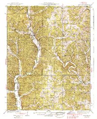
Other maps of this area

1910 · Higdon
USGS Topo · 1:62,500

1923 · Perryville
USGS Topo · 1:62,500

1924 · Perryville
USGS Topo · 1:62,500

1933 · Marble Hill
USGS Topo · 1:62,500

1933 · Marquand
USGS Topo · 1:62,500
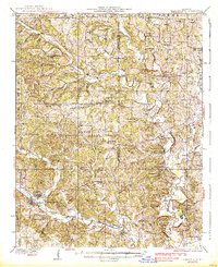
1937 · Marble Hill
USGS Topo · 1:62,500
1938 · Marquand
USGS Topo · 1:62,500

1949 · Paducah
USGS Topo · 1:250,000

1949 · Rolla
USGS Topo · 1:250,000

1950 · Paducah
USGS Topo · 1:250,000