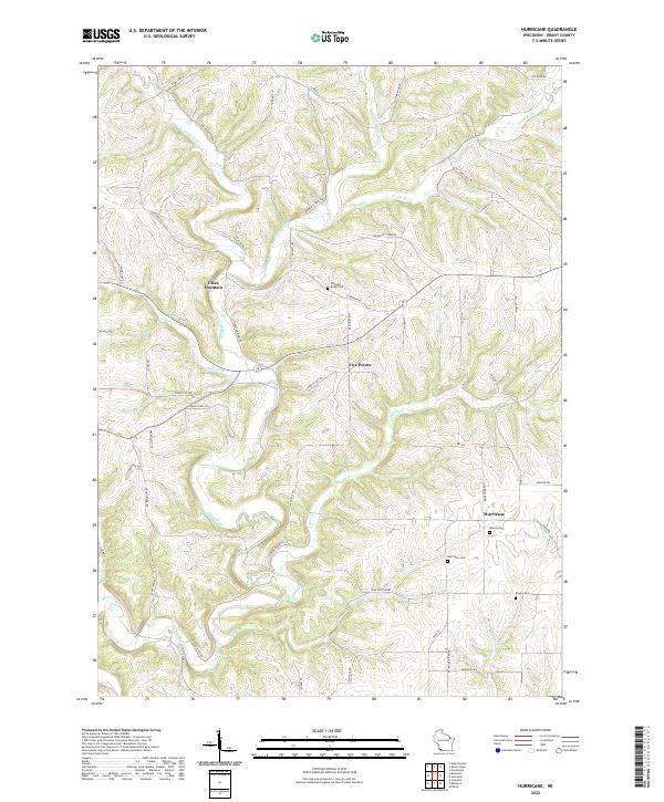
2022 Map of Hurricane
USGS Topo · Published 2022About this map
The Grant River and its numerous tributaries, including Little Grant River and Pigeon Cr, carve a complex drainage pattern through this portion of Grant County. Small settlements such as Hurricane, Flora Fountain, and Five Points anchor a landscape defined by ridgeline roads and deep valleys. The distribution of family and community burial sites, such as Pleasant Ridge Cem, Morrell Cem, and Kinney Cem, indicates a long-settled rural character maintained through the early 21st century. Road names like Grays Mill Rd, Bowen School Rd, and Slabtown Rd hint at former centers of local industry and education that shaped the social fabric of the townships. This topographic study captures the area's transition from the upland divides down to the river bottoms at a time when the traditional land divisions of T4N R4W and T3N R3W remain the fundamental grid for this Wisconsin community.
Find a feature on this map
59 named features on this map. Tap any name to fly to it.
Don’t see what you’re looking for? This feature index may not catch every label — zoom into the map to look around manually.
Map Details
Editions of this 2022 Hurricane Map
This is the sole edition of this map. No revisions or reprints were ever made.
Other maps of this area

1900 · Lancaster
USGS Topo · 1:125,000

1904 · Lancaster
USGS Topo · 1:125,000

1908 · Lancaster
USGS Topo · 1:125,000

1955 · Cassville
USGS Topo · 1:24,000

1955 · Balltown
USGS Topo · 1:24,000

1957 · Potosi
USGS Topo · 1:24,000

1959 · Dubuque
USGS Topo · 1:250,000

1961 · Dubuque
USGS Topo · 1:250,000

1962 · Dubuque
USGS Topo · 1:250,000
1962 · Mount Hope
USGS Topo · 1:24,000