
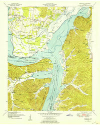
1936 Map of Hustburg
USGS Topo · Published 1936About this map
The Tennessee River and Duck River define the terrain of Humphreys County in the mid-1930s, creating a complex network of landings and river-bottom agriculture. This Tennessee Valley Authority survey shows the landscape before major hydroelectric developments significantly altered these riverbanks. The map documents numerous river access points like Byrds Landing and Pavatt Landing, which served as vital connections for local commerce and travel. Interior settlements such as Hustburg and Bakerville are shown in relation to the rural school system, including Tribble Sch and the Rock College Sch. Family history is preserved through labels for the Crockett Cem and Fowlkes Cem, while the rugged nature of the Tennessee hills is evident in features like Eagle Creek Ridge and the Sink Hole.
Find a feature on this map
83 named features on this map. Tap any name to fly to it.
Don’t see what you’re looking for? This feature index may not catch every label — zoom into the map to look around manually.
Map Details
Editions of this 1936 Hustburg Map
This is the sole edition of this map. No revisions or reprints were ever made.
Other maps of this area

1936 · Hurricane Mills
USGS Topo · 1:24,000

1936 · Camden
USGS Topo · 1:24,000

1936 · Daniels Landing
USGS Topo · 1:24,000

1936 · Johnsonville
USGS Topo · 1:24,000

1936 · Sugar Tree
USGS Topo · 1:24,000

1936 · Lobelville
USGS Topo · 1:24,000

1936 · Rockport
USGS Topo · 1:24,000

1936 · Waverly
USGS Topo · 1:24,000

1949 · Daniels Landing
USGS Topo · 1:24,000
1949 · Hustburg
USGS Topo · 1:24,000