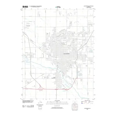
2010 Map of Hutchinson
USGS Topo · Published 2010About this map
Hutchinson is depicted at a time of significant urban expansion across the Kansas plains, with a street grid that stretches north toward the residential enclave of Willowbrook. The landscape is dominated by the broad course of the Arkansas River, which separates the main city from South Hutchinson to the south. Along the river’s western banks, Arkansas Ridge rises slightly above the valley floor, while tributaries like Cow Creek and Salt Creek wind through the outlying sections. Genealogical researchers will find localized detail in the town's burial grounds, including the large Fairlawn Cemetery and Eastside Cemetery, alongside the more unusual Erickson Animal Cemetery located on the northwest outskirts. This 2010 survey illustrates the transition from the dense downtown core to modern subdivisions, such as those surrounding Panorama Lake in the northeast quadrant.
Find a feature on this map
133 named features on this map. Tap any name to fly to it.
Don’t see what you’re looking for? This feature index may not catch every label — zoom into the map to look around manually.
Map Details
Editions of this 2010 Hutchinson Map
This is the sole edition of this map. No revisions or reprints were ever made.
Other maps of this area

1889 · Cheney
USGS Topo · 1:125,000

1891 · Hutchinson
USGS Topo · 1:125,000

1891 · Cheney
USGS Topo · 1:125,000

1892 · Kingman
USGS Topo · 1:125,000

1893 · Hutchinson
USGS Topo · 1:125,000

1894 · Kingman
USGS Topo · 1:125,000

1894 · Lyons
USGS Topo · 1:125,000

1901 · Cheney
USGS Topo · 1:125,000

1955 · Wichita
USGS Topo · 1:250,000

1955 · Great Bend
USGS Topo · 1:250,000