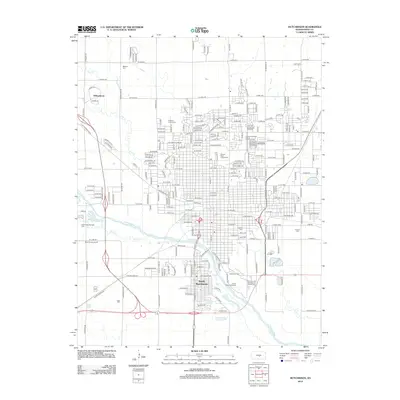
2012 Map of Hutchinson
USGS Topo · Published 2012About this map
The Arkansas River and Cow Cr converge near the heart of this Reno County landscape, shaping the development of the city and its surrounding areas. This 2012 survey illustrates the modern expansion of South Hutchinson and the residential pocket of Willowbrook to the northwest. The urban grid is defined by extensive recreational and public spaces, most notably the Kansas State Fairgrounds and the sprawling Carey Park Golf Course. Genealogy researchers will find several significant burial grounds documented, including Mitchell Cem, Fairlawn Cem, and Eastside Cem, providing a clear record of local family history and community interment patterns. The map also highlights unique local landmarks such as the Hutchinson Zoo and the Erickson Animal Cem, reflecting the specialized land use within this Kansas plains hub.
Find a feature on this map
96 named features on this map. Tap any name to fly to it.
Don’t see what you’re looking for? This feature index may not catch every label — zoom into the map to look around manually.
Map Details
Editions of this 2012 Hutchinson Map
This is the sole edition of this map. No revisions or reprints were ever made.
Other maps of this area

1889 · Cheney
USGS Topo · 1:125,000

1891 · Hutchinson
USGS Topo · 1:125,000

1891 · Cheney
USGS Topo · 1:125,000

1892 · Kingman
USGS Topo · 1:125,000

1893 · Hutchinson
USGS Topo · 1:125,000

1894 · Kingman
USGS Topo · 1:125,000

1894 · Lyons
USGS Topo · 1:125,000

1901 · Cheney
USGS Topo · 1:125,000

1955 · Wichita
USGS Topo · 1:250,000

1955 · Great Bend
USGS Topo · 1:250,000