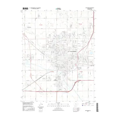
2015 Map of Hutchinson
USGS Topo · Published 2015About this map
Hutchinson is depicted here as the sprawling center of Reno County, situated where the Arkansas River and Cow Cr converge. The urban landscape is meticulously detailed, showing the layout of the city and its neighboring community of South Hutchinson, as well as the smaller enclave of Willowbrook to the northwest. For those researching local history or genealogy, the map identifies several significant locations including Eastside Cem and Fairlawn Cem, along with the more unique Erickson Animal Cem. Educational development is represented by the Hutchinson Community Coll campus.
Find a feature on this map
252 named features on this map. Tap any name to fly to it.
Don’t see what you’re looking for? This feature index may not catch every label — zoom into the map to look around manually.
Map Details
Editions of this 2015 Hutchinson Map
This is the sole edition of this map. No revisions or reprints were ever made.
Other maps of this area

1889 · Cheney
USGS Topo · 1:125,000

1891 · Hutchinson
USGS Topo · 1:125,000

1891 · Cheney
USGS Topo · 1:125,000

1892 · Kingman
USGS Topo · 1:125,000

1893 · Hutchinson
USGS Topo · 1:125,000

1894 · Kingman
USGS Topo · 1:125,000

1894 · Lyons
USGS Topo · 1:125,000

1901 · Cheney
USGS Topo · 1:125,000

1955 · Wichita
USGS Topo · 1:250,000

1955 · Great Bend
USGS Topo · 1:250,000