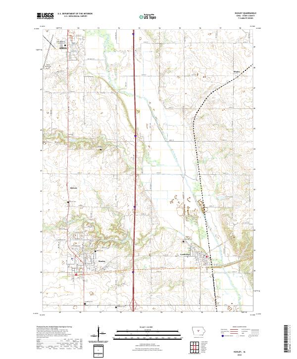
2022 Map of Huxley
USGS Topo · Published 2022About this map
The South Skunk River meanders through the heart of this central Iowa landscape, shaping the terrain between the growing southern edge of Ames and the surrounding rural communities. Modern infrastructure dominates the western corridor, where the Ames Municipal Airport and the busy thoroughfare of Interstate 35 define the local geography. In the southern portion of the quadrangle, the city of Huxley sits near the crossing of the Heart of Iowa Nature Trl, a recreational path that repurposes older transportation corridors.
Find a feature on this map
88 named features on this map. Tap any name to fly to it.
Don’t see what you’re looking for? This feature index may not catch every label — zoom into the map to look around manually.
Map Details
Editions of this 2022 Huxley Map
This is the sole edition of this map. No revisions or reprints were ever made.
Other maps of this area

1911 · Slater
USGS Topo · 1:62,500

1912 · Ames
USGS Topo · 1:62,500

1913 · Slater
USGS Topo · 1:62,500

1914 · Ames
USGS Topo · 1:62,500

1954 · Waterloo
USGS Topo · 1:250,000

1954 · Des Moines
USGS Topo · 1:250,000

1955 · Waterloo
USGS Topo · 1:250,000

1956 · Des Moines
USGS Topo · 1:250,000

1957 · Des Moines
USGS Topo · 1:250,000

1969 · Des Moines
USGS Topo · 1:250,000