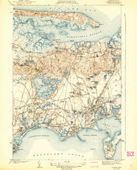
1942 Map of Hyannis
USGS Topo · Published 1942About this map
The narrow spit of Sandy Neck shields Barnstable Harbor in this 1939 survey of the Cape Cod mid-section. This era captures the region's dual identity as a maritime hub and a growing residential center, anchored by the dense street grids of Hyannis and Barnstable. Transportation is a central theme, with the tracks of the New York New Haven and Hartford RR cutting across the landscape through Yarmouth Sta and West Barnstable. Local landmarks like the Sandy Neck Lighthouse and the early layout of the Hyannis Airport stand alongside cultural fixtures including the Teachers College and the Fair Grounds. Genealogists will find significant detail in the mapped burial sites, such as Lothrop Hill Cem and Beechwood Cem, while the intricate network of inland ponds like Chequaquet Lake and Mary Dunn Pond defines the peninsula's topography.
Find a feature on this map
103 named features on this map. Tap any name to fly to it.
Don’t see what you’re looking for? This feature index may not catch every label — zoom into the map to look around manually.
Map Details
Editions of this 1942 Hyannis Map
4 editions found
Other maps of this area

1887 · Yarmouth
USGS Topo · 1:62,500

1888 · Barnstable
USGS Topo · 1:62,500

1889 · Yarmouth
USGS Topo · 1:62,500

1893 · Yarmouth
USGS Topo · 1:62,500

1893 · Barnstable
USGS Topo · 1:62,500

1938 · Sandwich
USGS Topo · 1:31,680
1939 · Sandwich
USGS Topo · 1:24,000
1940 · Sandwich
USGS Topo · 1:31,680
1941 · Cotuit
USGS Topo · 1:31,680

1942 · Cape Cod Bay
USGS Topo · 1:125,000