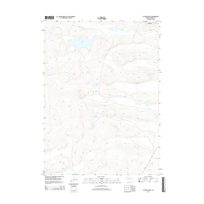
2014 Map of Hyannis South
USGS Topo · Published 2014About this map
The village of Hyannis occupies the northeastern corner of this Grant County landscape, serving as a primary point of settlement along the intersection of Ne-2 and Ne-61. The terrain is defined by the high, rolling dunes of the Nebraska Sandhills, which create a complex drainage pattern resulting in several localized water bodies. These depressions hold significant features such as George Lake and Cricket Lake, which are central to the hydrology of this semi-arid region. To the south, the landscape remains largely open and dominated by the natural topography, with Little Buckboard Lake and Sears Lake appearing as distinct landmarks amidst the dunes. Farther south, Lynch Rd provides access through this ranching country, tracing the base of the hills where the sandy soil meets the few established transport corridors of the early 21st century.
Find a feature on this map
9 named features on this map. Tap any name to fly to it.
Don’t see what you’re looking for? This feature index may not catch every label — zoom into the map to look around manually.
Map Details
Editions of this 2014 Hyannis South Map
This is the sole edition of this map. No revisions or reprints were ever made.
Other maps of this area

1948 · Ashby
USGS Topo · 1:62,500

1948 · George Lake
USGS Topo · 1:62,500

1948 · Whitman
USGS Topo · 1:62,500

1948 · Spring Valley
USGS Topo · 1:62,500

1949 · Ashby
USGS Topo · 1:62,500

1950 · Spring Valley
USGS Topo · 1:62,500

1950 · Whitman
USGS Topo · 1:62,500

1950 · George Lake
USGS Topo · 1:62,500

1954 · North Platte
USGS Topo · 1:250,000

1956 · North Platte
USGS Topo · 1:250,000