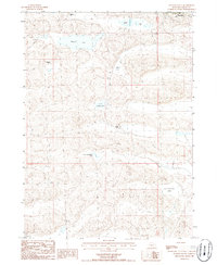
1986 Map of Hyannis South
USGS Topo · Published 1986About this map
The high plains of western Nebraska's sandhills country define this landscape, anchored by the village of Hyannis in the northeastern corner. In the mid-1980s, the area remained a sparse network of cattle operations and seasonal wetlands, with family legacies recorded at the Paul Sweet Ranch, Sid Sweet Ranch, and Minor Ranch. The terrain is dominated by closed-basin lakes of varying sizes, including the expansive George Lake and the descriptive Alkali Lake. Local history and genealogy are highlighted by the Cem located near the town center, while physical changes to the earth are noted by a Spoil Bank and the presence of both Big Buckboard Lake and Little Buckboard Lake. The map illustrates the specialized ranching economy of Grant County, where water resources like Cricket Lake and Sears Lake are critical markers across the undulating hills.
Find a feature on this map
13 named features on this map. Tap any name to fly to it.
Don’t see what you’re looking for? This feature index may not catch every label — zoom into the map to look around manually.
Map Details
Editions of this 1986 Hyannis South Map
This is the sole edition of this map. No revisions or reprints were ever made.
Other maps of this area

1948 · Ashby
USGS Topo · 1:62,500

1948 · George Lake
USGS Topo · 1:62,500

1948 · Whitman
USGS Topo · 1:62,500

1948 · Spring Valley
USGS Topo · 1:62,500

1949 · Ashby
USGS Topo · 1:62,500

1950 · Spring Valley
USGS Topo · 1:62,500

1950 · Whitman
USGS Topo · 1:62,500

1950 · George Lake
USGS Topo · 1:62,500

1954 · North Platte
USGS Topo · 1:250,000

1956 · North Platte
USGS Topo · 1:250,000