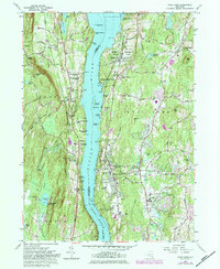
1980 Map of Hyde Park
USGS Topo · Published 1984About this map
The Hudson River bisects this landscape, separating the wooded ridges of Esopus in Ulster County from the expansive estates and riverfront hamlets of Hyde Park in Dutchess County. This stretch of the river valley is characterized by significant religious and educational institutions, including the Holy Cross Monastery and the Mt St Alphonsus Seminary overlooking the water. Navigation landmarks like the Esopus Meadows Lighthouse and Esopus Island Lighthouse guide the way through the Lange Rack reach of the river. On the eastern shore, the transition from gilded age estates to mid-century growth is evident, anchored by the Vanderbilt Mansion National Historic Site and the F D Roosevelt Home National Historic Site. Settlement patterns follow the Conrail line and the north-south corridor of Post Road, connecting Staatsburg and West Park across the water.
Find a feature on this map
111 named features on this map. Tap any name to fly to it.
Don’t see what you’re looking for? This feature index may not catch every label — zoom into the map to look around manually.
Map Details
Editions of this 1980 Hyde Park Map
2 editions found
Other maps of this area

1893 · Poughkeepsie
USGS Topo · 1:62,500

1894 · Poughkeepsie
USGS Topo · 1:62,500

1898 · Rhinebeck
USGS Topo · 1:62,500

1901 · Rosendale
USGS Topo · 1:62,500

1903 · Poughkeepsie
USGS Topo · 1:62,500

1903 · Newburg
USGS Topo · 1:62,500

1903 · Rosendale
USGS Topo · 1:62,500

1934 · Rhinebeck
USGS Topo · 1:48,000

1936 · Poughkeepsie
USGS Topo · 1:48,000

1939 · Rhinebeck
USGS Topo · 1:62,500