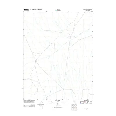
2012 Map of Hyde Well
USGS Topo · Published 2012About this map
Hyde Well marks the primary point of settlement in this arid stretch of Lincoln County, where the landscape is defined by the ephemeral drainage systems of the eastern Nevada desert. The terrain is structured around the sprawling Hyde Wash, which cuts across the quadrangle and is supplemented by a network of water management features. Artificial watercourses including West Ditch and East Ditch run roughly parallel to Rosencrans Creek, illustrating the vital importance of irrigation and water control in this environment. The map details a network of roads and trails that converge at the well, suggesting its role as a local hub for ranching or land management in the early 21st century.
Find a feature on this map
5 named features on this map. Tap any name to fly to it.
Don’t see what you’re looking for? This feature index may not catch every label — zoom into the map to look around manually.
Map Details
Editions of this 2012 Hyde Well Map
This is the sole edition of this map. No revisions or reprints were ever made.
Other maps of this area

1956 · Lund
USGS Topo · 1:250,000

1960 · Lund
USGS Topo · 1:250,000

1972 · Rosencrans Knolls
USGS Topo · 1:24,000

1972 · Hamlin Well
USGS Topo · 1:24,000

1972 · Miller Wash
USGS Topo · 1:24,000

1972 · Hyde Well
USGS Topo · 1:24,000
1972 · Tweedy Wash
USGS Topo · 1:24,000

1972 · Big Springs
USGS Topo · 1:24,000

1973 · Atlanta
USGS Topo · 1:24,000

1973 · Red Ledges
USGS Topo · 1:24,000