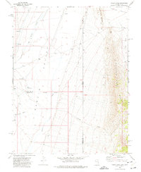
1972 Map of Tweedy Wash
USGS Topo · Published 1975About this map
Hamlin Valley serves as the central corridor of this arid landscape, where the state boundary between Nevada and Utah runs north-to-south through the high desert basins. The map illustrates a region defined by water management and sparse ranching infrastructure, featuring essential watering points such as North Little Springs, South Little Springs, and Big Spring Wash. The terrain is steeply defined to the east by the Mountain Home Range and Needle Point Mountain, while the valley floor is etched by drainage networks like Hamlin Valley Wash and Tweedy Wash. Traces of human activity are minimal but significant for the era, including a Corral, a Storage Bin, and a cluster of features known as The Pots. The presence of a solitary Well and various Jeep Trails underscores the seasonal and remote nature of resource extraction and livestock grazing in the early 1970s.
Find a feature on this map
21 named features on this map. Tap any name to fly to it.
Don’t see what you’re looking for? This feature index may not catch every label — zoom into the map to look around manually.
Map Details
Editions of this 1972 Tweedy Wash Map
This is the sole edition of this map. No revisions or reprints were ever made.
Other maps of this area

1949 · Garrison
USGS Topo · 1:62,500

1951 · Garrison
USGS Topo · 1:62,500

1953 · Richfield
USGS Topo · 1:250,000

1956 · Lund
USGS Topo · 1:250,000

1958 · Richfield
USGS Topo · 1:250,000

1960 · Lund
USGS Topo · 1:250,000

1960 · Burbank Hills
USGS Topo · 1:62,500

1971 · Mountain Home Pass
USGS Topo · 1:24,000

1971 · Mormon Gap
USGS Topo · 1:24,000

1972 · Miller Wash
USGS Topo · 1:24,000