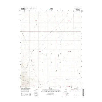
2014 Map of Hyde Well
USGS Topo · Published 2014About this map
Hamlin Valley defines the eastern expanse of this Lincoln County survey, where the arid basin floor meets the rising elevations of the Limestone Hills in the southwest. The landscape is characterized by a network of drainage features and infrastructure essential for desert survival, centered on the Hyde Well settlement. A series of water management channels, including the E Ditch, W Ditch, and Rosencrans Cr, redirect flow through the alluvial plains of Hyde Wash.
Find a feature on this map
18 named features on this map. Tap any name to fly to it.
Don’t see what you’re looking for? This feature index may not catch every label — zoom into the map to look around manually.
Map Details
Editions of this 2014 Hyde Well Map
This is the sole edition of this map. No revisions or reprints were ever made.
Other maps of this area

1956 · Lund
USGS Topo · 1:250,000

1960 · Lund
USGS Topo · 1:250,000

1972 · Rosencrans Knolls
USGS Topo · 1:24,000

1972 · Hamlin Well
USGS Topo · 1:24,000

1972 · Miller Wash
USGS Topo · 1:24,000

1972 · Hyde Well
USGS Topo · 1:24,000
1972 · Tweedy Wash
USGS Topo · 1:24,000

1972 · Big Springs
USGS Topo · 1:24,000

1973 · Atlanta
USGS Topo · 1:24,000

1973 · Red Ledges
USGS Topo · 1:24,000