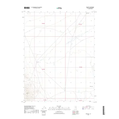
2018 Map of Hyde Well
USGS Topo · Published 2018About this map
Hyde Well serves as the namesake feature for this Lincoln County landscape, where the flat expanse of Hamlin Valley is defined by a network of drainage and irrigation. The terrain is marked by seasonal watercourses like Hyde Wash and Rosencrans Cr, which interact with a managed water system composed of the East Ditch, West Ditch, E Ditch, and W Ditch. These man-made channels suggest a history of water management and livestock grazing in this high-desert basin. Surveyed in the modern era, the map provides precise section lines and township boundaries, including t9n r69e and t8n r70e, reflecting the enduring Public Land Survey System structure that governs this part of rural Nevada.
Find a feature on this map
14 named features on this map. Tap any name to fly to it.
Don’t see what you’re looking for? This feature index may not catch every label — zoom into the map to look around manually.
Map Details
Editions of this 2018 Hyde Well Map
This is the sole edition of this map. No revisions or reprints were ever made.
Other maps of this area

1956 · Lund
USGS Topo · 1:250,000

1960 · Lund
USGS Topo · 1:250,000

1972 · Rosencrans Knolls
USGS Topo · 1:24,000

1972 · Hamlin Well
USGS Topo · 1:24,000

1972 · Miller Wash
USGS Topo · 1:24,000

1972 · Hyde Well
USGS Topo · 1:24,000
1972 · Tweedy Wash
USGS Topo · 1:24,000

1972 · Big Springs
USGS Topo · 1:24,000

1973 · Atlanta
USGS Topo · 1:24,000

1973 · Red Ledges
USGS Topo · 1:24,000