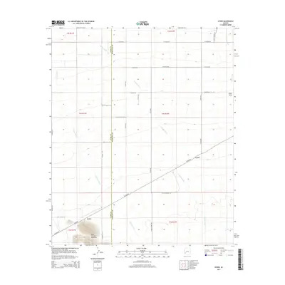
2014 Map of Hyder
USGS Topo · Published 2014About this map
Agua Caliente Mountains anchor the southwestern corner of this desert landscape, where the settlement of Hyder marks a transition between the rugged heights and the broad, wash-cut basin of the Hyder Valley. The terrain is defined by an intricate network of drainage channels, including Columbus Wash, Notthbusch Wash, and Copper Wash, which flow across the arid flats. This 2014 representation captures a sparsely populated region on the Yuma and Maricopa County line, structured by a grid of agricultural and access roads such as W Rhodes Ave and W Highline Rd. A notable historical trace appears in the alignment of W Butterfield Stage Rd, recalling the era of early overland travel through the Southwest. Small outposts like Camel and the various county-line corridors highlight the remote character of this high-desert environment.
Find a feature on this map
33 named features on this map. Tap any name to fly to it.
Don’t see what you’re looking for? This feature index may not catch every label — zoom into the map to look around manually.
Map Details
Editions of this 2014 Hyder Map
This is the sole edition of this map. No revisions or reprints were ever made.
Other maps of this area

1927 · Hyder
USGS Topo · 1:62,500

1929 · Aztec
USGS Topo · 1:62,500

1930 · Hyder
USGS Topo · 1:62,500

1942 · Vicksburg
USGS Topo · 1:250,000

1949 · Sentinel
USGS Topo · 1:62,500

1950 · Sentinel
USGS Topo · 1:62,500

1950 · Aztec
USGS Topo · 1:62,500

1951 · Dendora Valley
USGS Topo · 1:62,500

1953 · Ajo
USGS Topo · 1:250,000

1954 · Phoenix
USGS Topo · 1:250,000