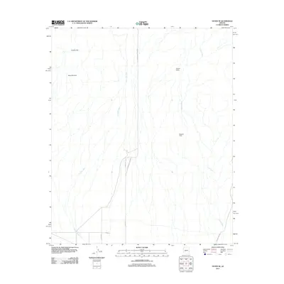
2011 Map of Hyder NE
USGS Topo · Published 2011About this map
Picacho Hills and Black Mountain dominate the western landscape of this Maricopa County desert region, serving as prominent landmarks above the surrounding drainage basins. The area is defined by a series of ephemeral watercourses, most notably Columbus Wash and Copper Wash, which channel seasonal runoff toward the south. Settlement is sparse, with the map showing a transition from the elevated Copper Valley down to the broader Sacaton Flats. The local infrastructure is primarily composed of desert corridors such as S Harquahala Hyder Rd and Agua Caliente Rd, which provide access through the arid terrain. The geometry of the road system, including S 579th Ave and 579th St, suggests a formal survey of the land even in this sparsely populated corner of the Arizona desert during the early 21st century.
Find a feature on this map
11 named features on this map. Tap any name to fly to it.
Don’t see what you’re looking for? This feature index may not catch every label — zoom into the map to look around manually.
Map Details
Editions of this 2011 Hyder NE Map
This is the sole edition of this map. No revisions or reprints were ever made.
Other maps of this area

1927 · Hyder
USGS Topo · 1:62,500

1930 · Hyder
USGS Topo · 1:62,500

1942 · Vicksburg
USGS Topo · 1:250,000

1951 · Dendora Valley
USGS Topo · 1:62,500

1954 · Phoenix
USGS Topo · 1:250,000

1957 · Phoenix
USGS Topo · 1:250,000

1958 · Phoenix
USGS Topo · 1:250,000

1960 · Phoenix
USGS Topo · 1:250,000

1962 · Cortez Peak
USGS Topo · 1:62,500

1962 · Eagletail Mts
USGS Topo · 1:62,500