2021 Map of Iantha
USGS Topo · Published 2021About this map
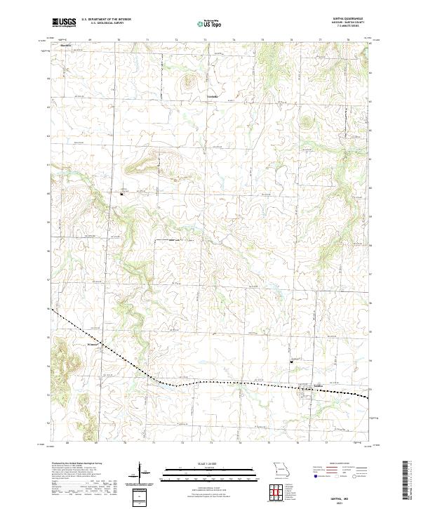
The W Fork River and its various tributaries define the low-lying prairie landscape of Barton County. Small, established rural communities such as Iantha and Verdella are connected by a precise grid of township and range roads, reflecting the systematic land division characteristic of the region. Local history is anchored by sites like Iantha Cem and Barton City Cem, which serve as permanent markers of early settlement patterns near the headwaters of E Fork Dry Wood Cr. The drainage network, including Comstock Cr and Bucks Run Cr, illustrates how natural waterways shaped the placement of farmsteads and the orientation of secondary roads like W HWY V. This map provides a clear view of the area's agricultural layout and small-town infrastructure in the early 21st century.
Find a feature on this map
33 named features on this map. Tap any name to fly to it.
Don’t see what you’re looking for? This feature index may not catch every label — zoom into the map to look around manually.
Map Details
Editions of this 2021 Iantha Map
This is the sole edition of this map. No revisions or reprints were ever made.