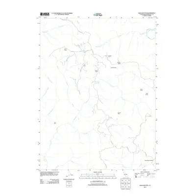
2012 Map of Iaqua Buttes
USGS Topo · Published 2012About this map
Lone Star Junction serves as a navigational anchor in this corner of Humboldt County, where mountain roads meet along the southeastern edge of the map. The landscape is defined by the high, wooded terrain of the Coast Ranges, marked by prominent features like Iaqua Buttes and Ashfield Butte. This 2012 survey illustrates the remote, upland character of the region, where infrastructure is concentrated along ridges such as Barry Ridge and Ashfield Ridge.
Find a feature on this map
31 named features on this map. Tap any name to fly to it.
Don’t see what you’re looking for? This feature index may not catch every label — zoom into the map to look around manually.
Map Details
Editions of this 2012 Iaqua Buttes Map
This is the sole edition of this map. No revisions or reprints were ever made.
Other maps of this area

1922 · Eureka
USGS Topo · 1:62,500

1922 · Korbel
USGS Topo · 1:62,500

1922 · Kneeland
USGS Topo · 1:62,500

1933 · Eureka
USGS Topo · 1:48,000

1942 · Eureka
USGS Topo · 1:62,500

1944 · Fortuna
USGS Topo · 1:62,500

1945 · Blue Lake
USGS Topo · 1:62,500

1949 · Eureka
USGS Topo · 1:250,000

1950 · Iaqua Buttes
USGS Topo · 1:62,500

1951 · Eureka
USGS Topo · 1:62,500