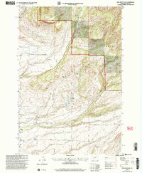
2000 Map of Ibex Mountain
USGS Topo · Published 2005About this map
Gallatin National Forest lands dominate this high-elevation landscape, where the Livingston Ranger District manages a terrain defined by the peaks of Ibex Mountain and Elk Mountain. The map reveals a pattern of rural settlement concentrated along the drainages of Cottonwood Creek and Rock Creek, where established ranching operations like Cox Ranch, Foster Ranch, and Criswell Ranch are situated. These family-named holdings highlight the region's enduring agricultural identity at the turn of the 21st century.
Find a feature on this map
25 named features on this map. Tap any name to fly to it.
Don’t see what you’re looking for? This feature index may not catch every label — zoom into the map to look around manually.
Map Details
Editions of this 2000 Ibex Mountain Map
This is the sole edition of this map. No revisions or reprints were ever made.
Other maps of this area

1886 · Little Belt Mts.
USGS Topo · 1:250,000

1891 · Livingston
USGS Topo · 1:250,000

1893 · Livingston
USGS Topo · 1:250,000

1894 · Little Belt Mts.
USGS Topo · 1:250,000

1897 · Little Belt Mts.
USGS Topo · 1:250,000

1898 · Little Belt Mts.
USGS Topo · 1:250,000

1902 · Little Belt Mts.
USGS Topo · 1:250,000

1947 · Bozeman
USGS Topo · 1:250,000

1948 · Bozeman
USGS Topo · 1:250,000

1948 · White Sulphur Springs
USGS Topo · 1:250,000