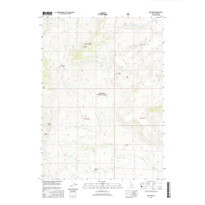
2017 Map of Ibex Peak
USGS Topo · Published 2017About this map
Sawtooth National Forest encompasses the high country of Cassia County in this modern survey, where the drainages of Beaverdam Cr and its various forks carve through the landscape. The geography is defined by a network of named springs that supported life and livestock in this arid environment, including Mabey Spring, Swede Spring, and Triple Spring. High points such as Ibex Peak overlook narrow corridors like Ibex Hollow and Cave Gulch. The map illustrates a complex system of canyon navigation and water access, notably around Beaverdam Pass and Daves Pass, where topographic features dictate the movement of water and travel across the range. Small watercourses like Owens Corral Cr and Fall Cr further define the intricate watershed patterns of this Idaho backcountry.
Find a feature on this map
47 named features on this map. Tap any name to fly to it.
Don’t see what you’re looking for? This feature index may not catch every label — zoom into the map to look around manually.
Map Details
Editions of this 2017 Ibex Peak Map
This is the sole edition of this map. No revisions or reprints were ever made.
Other maps of this area

1954 · Pocatello
USGS Topo · 1:250,000

1954 · Brigham City
USGS Topo · 1:250,000

1955 · Twin Falls
USGS Topo · 1:250,000

1955 · Wells
USGS Topo · 1:250,000

1958 · Wells
USGS Topo · 1:250,000

1958 · Twin Falls
USGS Topo · 1:250,000

1958 · Pocatello
USGS Topo · 1:250,000

1958 · Brigham City
USGS Topo · 1:250,000
1959 · Cotton Thomas Basin
USGS Topo · 1:62,500

1961 · Wells
USGS Topo · 1:250,000