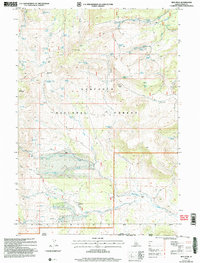
2001 Map of Ibex Peak
USGS Topo · Published 2006About this map
Ibex Peak anchors this high-elevation corner of the Sawtooth National Forest, situated where the Idaho, Nevada, and Utah state lines converge. In the early 21st century, this remote landscape remained a domain of specialized ranching and exploration, evidenced by the Frish Ranch and Emery Ranch. The map highlights a network of mountain springs and canyons, including Joes Mountain and the distinctive Hole in the Wall terrain. Human activity is marked by isolated infrastructure like Wards Corral and the Prospect Worthington Mine, suggesting a history of small-scale mineral prospecting. Movement through the steep topography of Cassia Co is traced by persistent 4wd tracks that bridge high passes such as Beaverdam Pass and Daves Pass, connecting the drainages of Fall Creek and Beaverdam Creek.
Find a feature on this map
58 named features on this map. Tap any name to fly to it.
Don’t see what you’re looking for? This feature index may not catch every label — zoom into the map to look around manually.
Map Details
Editions of this 2001 Ibex Peak Map
This is the sole edition of this map. No revisions or reprints were ever made.
Other maps of this area

1954 · Pocatello
USGS Topo · 1:250,000

1954 · Brigham City
USGS Topo · 1:250,000

1955 · Twin Falls
USGS Topo · 1:250,000

1955 · Wells
USGS Topo · 1:250,000

1958 · Wells
USGS Topo · 1:250,000

1958 · Twin Falls
USGS Topo · 1:250,000

1958 · Pocatello
USGS Topo · 1:250,000

1958 · Brigham City
USGS Topo · 1:250,000

1959 · Cotton Thomas Basin
USGS Topo · 1:62,500

1961 · Wells
USGS Topo · 1:250,000