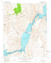
1953 Map of Iceberg Canyon
USGS Topo · Published 1964About this map
The Colorado River winds through the high desert of the Hiller Mountains and the Kitchen in this mid-century survey of the Nevada-Arizona border. The landscape is defined by the early stages of Lake Mead filling the deep canyons, with underwater contours indicating the submerged topography of Iceberg Canyon and Virgin Canyon. The map records a period of transition, showing both active and defunct infrastructure from earlier mining and river crossing eras.
Find a feature on this map
94 named features on this map. Tap any name to fly to it.
Don’t see what you’re looking for? This feature index may not catch every label — zoom into the map to look around manually.
Map Details
Editions of this 1953 Iceberg Canyon Map
3 editions found

Other maps of this area

1886 · Diamond Creek
USGS Topo · 1:250,000

1886 · Camp Mohave
USGS Topo · 1:250,000

1886 · Saint Thomas
USGS Topo · 1:250,000

1886 · Mt. Trumbull
USGS Topo · 1:250,000

1892 · Diamond Creek
USGS Topo · 1:250,000

1892 · Mt. Trumbull
USGS Topo · 1:250,000

1892 · Camp Mohave
USGS Topo · 1:250,000

1893 · Saint Thomas
USGS Topo · 1:250,000

1926 · Bonelli
USGS Topo · 1:96,000

1942 · Camp Mohave
USGS Topo · 1:250,000