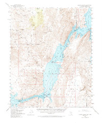
1953 Map of Iceberg Canyon
USGS Topo · Published 1974About this map
Lake Mead and the Colorado River dominate this desert landscape where the borders of Clark County, Nevada, and Mohave County, Arizona, meet. This early 1950s survey captures the region's transition into a recreational hub following the creation of the reservoir, yet it remains heavily marked by the legacy of extraction. Mining prospects like the Nevada Mica Mine, Eureka Mine, and Joker Mine are scattered across the high ground of the Hiller Mountains and the Jumbo Basin. The map provides significant underwater detail through depth contours in Gregg Basin and near Virgin Reef, reflecting sedimentation studies of the era. Transportation is limited to rugged tracks such as the Jumbo Jeep Trail and the historic Scanlon Dugway, while named landmarks like Hualapai Island and Sandy Point define the shifting shoreline of the Lake Mead National Recreational Area.
Find a feature on this map
85 named features on this map. Tap any name to fly to it.
Don’t see what you’re looking for? This feature index may not catch every label — zoom into the map to look around manually.
Map Details
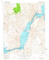
Editions of this 1953 Iceberg Canyon Map
3 editions found

Other maps of this area

1886 · Diamond Creek
USGS Topo · 1:250,000

1886 · Camp Mohave
USGS Topo · 1:250,000

1886 · Saint Thomas
USGS Topo · 1:250,000

1886 · Mt. Trumbull
USGS Topo · 1:250,000

1892 · Diamond Creek
USGS Topo · 1:250,000

1892 · Mt. Trumbull
USGS Topo · 1:250,000

1892 · Camp Mohave
USGS Topo · 1:250,000

1893 · Saint Thomas
USGS Topo · 1:250,000

1926 · Bonelli
USGS Topo · 1:96,000

1942 · Camp Mohave
USGS Topo · 1:250,000