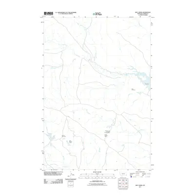
2011 Map of Ikey Creek
USGS Topo · Published 2011About this map
Ikey Creek and its many tributaries define this section of Carter County, Montana, revealing a landscape focused on ranching and water management. The drainage networks of Cabin Creek, Chitto Creek, and McCarty Creek are punctuated by numerous small dams and reservoirs, reflecting the importance of water catchment for livestock in this arid region. Named features such as Johnston and Son Ranch Number 4 Dam and One D-4 Ranch Dam suggest the long-standing family ranching operations that have shaped the land. This 2011 survey also highlights curious local nomenclature like Ding Dong Dam and Penny Dam, along with the solitary Ridge Rd that provides access through the higher ground. The map serves as a record of rural land usage where natural watercourses like South Creek and Flat Creek are augmented by human engineering to sustain the local economy.
Find a feature on this map
16 named features on this map. Tap any name to fly to it.
Don’t see what you’re looking for? This feature index may not catch every label — zoom into the map to look around manually.
Map Details
Editions of this 2011 Ikey Creek Map
This is the sole edition of this map. No revisions or reprints were ever made.
Other maps of this area

1954 · Ekalaka
USGS Topo · 1:250,000

1956 · Ekalaka
USGS Topo · 1:250,000

1958 · Ekalaka
USGS Topo · 1:250,000

1965 · Ekalaka
USGS Topo · 1:250,000

1979 · Dutchman Creek
USGS Topo · 1:24,000

1979 · Dead Boy Divide
USGS Topo · 1:24,000

1979 · Ikey Creek
USGS Topo · 1:24,000

1979 · Chalk Buttes
USGS Topo · 1:24,000

1980 · Taylor Hills
USGS Topo · 1:24,000

1980 · Prairie Dog Creek
USGS Topo · 1:24,000