
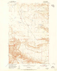
1954 Map of Iliad
USGS Topo · Published 1955About this map
Iliad and its surrounding prairie landscape are documented here during the mid-1950s as part of a development program for the Missouri River Basin. The topography is defined by a network of drainage channels including Chip Coulee, Sandstone Coulee, and Sage Coulee, which carve through the high plains toward the river system. The small settlement of Iliad is centered near the Iliad Sch, reflecting the sparse, school-district-based social structure of rural Chouteau County at the time.
Find a feature on this map
17 named features on this map. Tap any name to fly to it.
Don’t see what you’re looking for? This feature index may not catch every label — zoom into the map to look around manually.
Map Details
Editions of this 1954 Iliad Map
2 editions found
Other maps of this area

1953 · Starve Out Flat
USGS Topo · 1:24,000

1953 · Last Chance Bench
USGS Topo · 1:24,000

1954 · P N Ranch
USGS Topo · 1:24,000

1954 · Dark Butte
USGS Topo · 1:24,000

1954 · Lewistown
USGS Topo · 1:250,000

1959 · Lewistown
USGS Topo · 1:250,000

1964 · Pigtail Coulee
USGS Topo · 1:24,000
1984 · Seifort Reservoir
USGS Topo · 1:24,000
1984 · Eskay NW
USGS Topo · 1:24,000
1984 · Eagleton NW
USGS Topo · 1:24,000