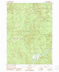
1989 Map of Illahe
USGS Topo · Published 1989About this map
Illahe sits at the southern edge of this late-twentieth-century survey, marking a small pocket of human settlement within the expansive Siskiyou National Forest. The landscape is dominated by the steep drainage basins of the South Fork Coquille River and its numerous tributaries, including Rock Creek and Billings Creek. High elevations are defined by prominent landforms such as Eden Ridge and Panther Ridge, while lower elevations along the waterways provide access to recreation sites like the Daphne Grove Campground.
Find a feature on this map
62 named features on this map. Tap any name to fly to it.
Don’t see what you’re looking for? This feature index may not catch every label — zoom into the map to look around manually.
Map Details
Editions of this 1989 Illahe Map
This is the sole edition of this map. No revisions or reprints were ever made.
Other maps of this area

1899 · Port Orford
USGS Topo · 1:125,000

1903 · Port Orford
USGS Topo · 1:125,000

1954 · Coos Bay
USGS Topo · 1:250,000

1954 · Bone Mountain
USGS Topo · 1:62,500

1954 · Marial
USGS Topo · 1:62,500

1954 · Agness
USGS Topo · 1:62,500

1954 · Powers
USGS Topo · 1:62,500

1955 · Medford
USGS Topo · 1:250,000

1957 · Medford
USGS Topo · 1:250,000

1958 · Medford
USGS Topo · 1:250,000