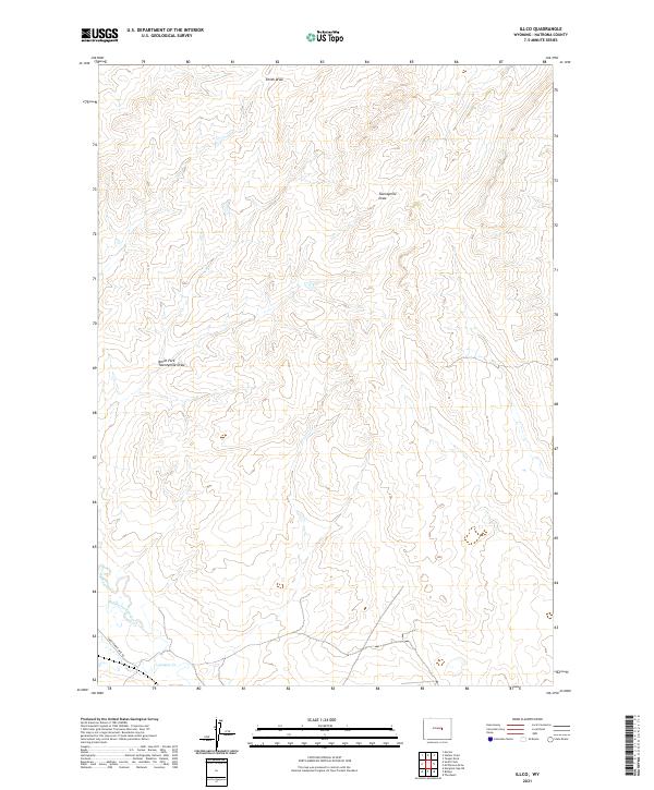
2021 Map of Illco
USGS Topo · Published 2021About this map
Natrona County's high plains drainage systems are clearly defined in this modern survey, which focuses on the intricate networks of seasonal draws and creeks that shape the Wyoming landscape. Thirtythree Mile Rd cuts across the southwestern corner of the quadrangle, providing the primary corridor through this open terrain. The hydrological pattern is dominated by the Casper Cr system, including the Middle Fork Casper Cr and N Fork Casper Cr, which converge as they move toward the south. To the north, the landscape is etched by the Twentymile Draw and its North Fork Twentymile Draw, alongside Smith Draw. These features represent the essential water-security landmarks for local land use and ranching history in a region defined by its wide, undeveloped stretches and subtle elevation changes.
Find a feature on this map
13 named features on this map. Tap any name to fly to it.
Don’t see what you’re looking for? This feature index may not catch every label — zoom into the map to look around manually.
Map Details
Editions of this 2021 Illco Map
This is the sole edition of this map. No revisions or reprints were ever made.
Other maps of this area

1950 · Emigrant Gap NE
USGS Topo · 1:24,000

1951 · The Reefs
USGS Topo · 1:24,000

1952 · Bishop
USGS Topo · 1:24,000

1955 · Arminto
USGS Topo · 1:250,000

1955 · Casper
USGS Topo · 1:250,000

1958 · Casper
USGS Topo · 1:250,000

1958 · Arminto
USGS Topo · 1:250,000
1960 · Bishop
USGS Topo · 1:24,000
1960 · Emigrant Gap NE
USGS Topo · 1:24,000
1961 · The Reefs
USGS Topo · 1:24,000