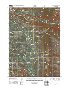
2011 Map of Imnaha Creek
USGS Topo · Published 2011About this map
The Middle Fork Rogue River and South Fork Rogue River dominate this 2011 drainage profile of the High Cascades region in Jackson County. This forest landscape is intricately networked by timber and access routes such as Parker Meadows Rd and Lodgepole Rd, which connect isolated features like King Spruce Camp to the wider valley. The complex hydrology of the area is defined by numerous tributaries including Imnaha Creek, Wallowa Creek, and Sumpter Creek, many of which originate near landmarks like Mudjekeewis Mountain and Gopher Ridge.
Find a feature on this map
46 named features on this map. Tap any name to fly to it.
Don’t see what you’re looking for? This feature index may not catch every label — zoom into the map to look around manually.
Map Details
Editions of this 2011 Imnaha Creek Map
This is the sole edition of this map. No revisions or reprints were ever made.
Other maps of this area

1891 · Ashland
USGS Topo · 1:250,000

1893 · Ashland
USGS Topo · 1:250,000

1897 · Ashland
USGS Topo · 1:250,000

1955 · Rustler Peak
USGS Topo · 1:62,500

1955 · Pelican Butte
USGS Topo · 1:62,500

1955 · Medford
USGS Topo · 1:250,000

1956 · Prospect
USGS Topo · 1:62,500

1957 · Medford
USGS Topo · 1:250,000

1958 · Medford
USGS Topo · 1:250,000
1985 · Rustler Peak
USGS Topo · 1:24,000